1972-1983: Leisure activities
It can be said that Ordnance Survey’s lasting solution for the poor public reaction to the 1:25 000 First Series was two-fold: Firstly by creating - in 1965 - the 1:25 000 Second Series for national coverage, and secondly - seven years later - by creating a series of selective-coverage 1:25 000 sheets, based on popular tourist areas. Given the scale and larger coverage area, the maps were ideally suited to countryside leisure activities - walking, cycling etc. - hence the ‘Outdoor Leisure’ moniker. Another benefit of the new series was that it appeased those sections of the public who demanded larger 1:25 000 sheets.
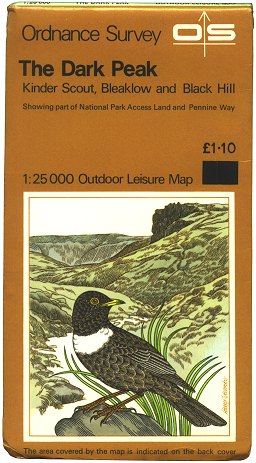 Figure 1 The Dark Peak (1972) |
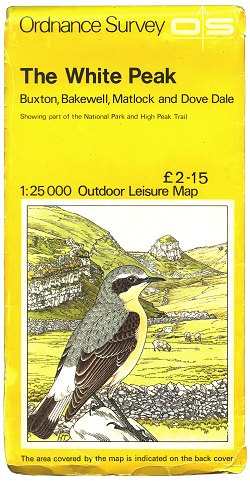 Figure 2 The White Peak (c.1981) |
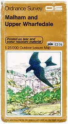 Figure 3 Malham and Upper Wharfedale (c.1977) |
The first Outdoor Leisure sheet to be published was The Dark Peak in 1972. This sheet covered an area of 20km × 26km, and was formed from material from six 1:25 000 Provisional Edition (First Series) sheets, incorporating partial revision and information of interest to tourists. The map cover used a variation on the ‘house style’ design, incorporating a dark orange-mustard background, and a drawing by artist Harry Titcombe. (Figure 1)
The next to be published was The Three Peaks in May 1973, also using 1:25 000 Provisional Edition material. This was followed by High Tops of the Cairngorms in June 1974, the first Outdoor Leisure sheet to be compiled using 1:25 000 Second Series mapping.
Over the next nine years, 24 more Outdoor Leisure sheets were published, with a different cover illustration for each new area. Sheets based on 1:25 000 Second Series material were given bright yellow covers, to distinguish them. (Figure 2)
As well as being issued in the standard ‘paper folded’ format, a few sheets - such as Malham & Upper Wharfedale (Figure 3) - were also published ‘printed on tear and water resistant material’ - another of OS’s many experiments in making maps ‘outdoors-proof’ through the years.
Some later Outdoor Leisure sheets (such as The White Peak, 1981) were printed double-sided, with half the coverage on the front face and half on the reverse face. This meant that Outdoor Leisure sheets could cover an area of anything up to approximately 1,250km² each.
1984-1991: Photo finish
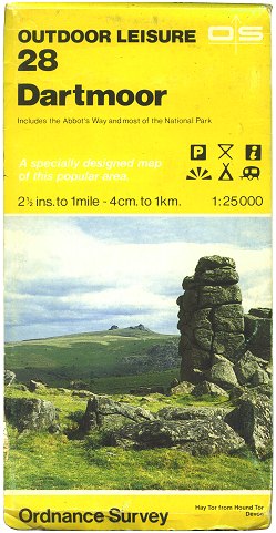 Figure 4a Outdoor Leisure sheet 28 Dartmoor (1984) |
 Figure 4b Outdoor Leisure sheet 13 Brecon Beacons (E) (c.1984) |
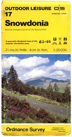 Figure 4c Outdoor Leisure sheet 17 Snowdonia (c.1984) |
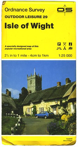 Figure 5 Outdoor Leisure sheet 29 Isle of Wight (1990) |
Dartmoor, published in April 1984, was the first Outdoor Leisure sheet to be issued in a photographic cover, and also the first sheet in the series to carry a clear sheet number - no. 28. (Figure 4a). The mapping was given a facelift, using full-colour printing and a new colour scheme which made road identification a great deal easier.
The cover printed for Dartmoor was a very preliminary version. Throughout the rest of 1984 further cover printings for the Outdoor Leisure series took place using slightly modified designs (Figures 4b, 4c). Further details of these early photographic cover designs on the Outdoor Leisure series can be found here.
Once a final design had been decided upon at the beginning of 1985 (much the same as the 1:50 000 Landranger Series) all previous sheets in the series were gradually re-issued in numbered photographic covers (Figure 5), and with the new mapping colour scheme.
The following year Ordnance Survey decided to discontinue or leave unpublished those sheets of the 1:25 000 Second Series wholly underlying Outdoor Leisure sheets.
New sheets in the Outdoor Leisure series continued to be published, while some others were discontinued, or merged with neighbouring sheets. This led to gaps in the numbering system, which were filled as they became available by newly-published sheets.
1992-1998: Mind the gaps
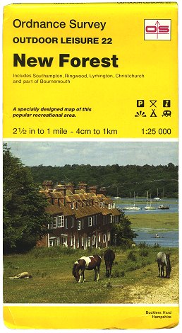 Figure 6 Outdoor Leisure sheet 22 New Forest (c.1994) |
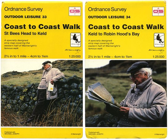 Figure 7 Outdoor Leisure sheets 33 & 34 Coast to Coast Walk - St Bees Head to Robin Hood’s Bay - Edition A (1994) |
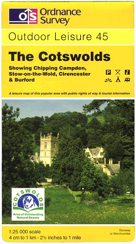 Figure 8 Outdoor Leisure sheet 45 The Cotswolds (1998) |
From 1992 the cover design was altered slightly - the OS logo was magenta inside a black-edged box. (Figure 6)
Two special Outdoor Leisure sheets were published in February 1994. These covered two halves of Alfred Wainwright’s coast-to-coast walk from Cumbria to Yorkshire. (Figure 7). The maps were unusual for Ordnance Survey in that they covered only a thin sliver of countryside around the route stretching the length of the 188-mile walk, along with detailed descriptions of the route adapted from Wainwright’s original text.
March 1994 saw the publication of the first sheets in the 1:25 000 Explorer series, designed to cover areas of the country not quite as popular as those covered by Outdoor Leisure maps. Between 1995 and 1998, several Outdoor Leisure sheets had their coverage extended, with many more becoming double-sided. This seems to have been intended to affirm Outdoor Leisure as the superior of the two series.
From 1996 the cover design was changed to include the new OS logo and house style. Also from this time gaps in Outdoor Leisure sheet numbering were no longer filled by new sheets. (There was one exception: Sheet 32 Galloway Forest Park - published March 1997, replacing sheet 32 Ben Nevis. Therefore, by February 1998, when the last new Outdoor Leisure sheet was published - sheet 45 The Cotswolds (Figure 8) - there were three unfilled gaps. These were: sheet 10 (merged with sheet 2 in November 1997), sheet 11 (merged with sheet 12 in July 1996) and sheet 25 (replaced by Explorer sheet 20 in November 1996).
2001-2002: Two become one
The last revised reprint in the Outdoor Leisure series was edition ‘A4’ of sheet 28 Dartmoor, published in March 2001. By late 2001 the Explorer series - which had since 1997 been gradually replacing the 1:25 000 Second Series - was nearing completion. From October 2001 until March 2002, 7 Outdoor Leisure sheets in Scotland (3, 8, 32, 37, 38, 39 and 44) were ‘downgraded’ and each split into two standard Explorer sheets.
Meanwhile, it was becoming clear that having two completely separate 1:25 000 series covering the country was not necessarily a satisfactory situation; some customers were confused as to which map they required. So it was in March 2002 that 33 sheets out of the 35 surviving in the Outdoor Leisure series were subsumed into the Explorer series. Each of these sheets retained its Outdoor Leisure sheet number, prefixed with ‘OL’. The two remaining Outdoor Leisure sheets (33 and 34 - the coast-to-coast walk) were discontinued altogether.
Page last updated: 14 April 2012