1962-1979: A fresh approach
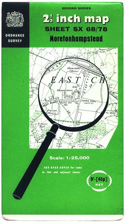 Figure 1 1:25 000 Second Series cover (1965 - 1970) |
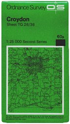 Figure 2 1:25 000 Second Series cover (1971 - c.1976) |
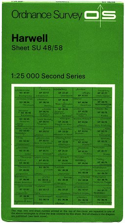 Figure 3 1:25 000 Second Series cover (c.1976 - 1980) |
The wrangling over 1:25 000 sheet sizes (see 1:25 000 First Series) was resolved in February 1962, when a sheet size of 20km × 10km was formally decided upon for the Second Series. Work was put in hand immediately on producing a pilot sheet for the Second Series. This was completed by March 1963, and the first 14 sheets of the full series were published in December 1965, in a green variation of the ‘mangifying-glass’ cover (Figure 1). At first this was unlaminated but from around Spring 1966 cover lamination was introduced.
Very few sheets of the Second Series were published in time to receive this cover, however - in January 1971 the somewhat uninspired ‘house style’ design was introduced to the series. This incorporated a diagram of the surrounding road network and sheet coverage area, with the titles of all surrounding sheets. (Figure 2)
The 1:25 000 Second Series maps were produced to a much improved specification, most importantly including quickly-recognisable symbols for public rights of way. The standard sheet size of 20km × 10km (varied slightly around the coasts) was widely welcomed, particularly by ramblers’ groups. The full national series was planned to cover Great Britain in around 1,400 sheets.
Despite the sheet-size wrangling supposedly being resolved, the 1:25 000 Second Series didn’t get an easy ride: a proposal for a change to 20km × 20km sheets was considered in 1969, and in 1973 the possibilty of abandoning the series was also considered, but rejected later the same year after public complaints. Another problem was the fact that the rate of publication of new sheets in the series was painfully slow. A gap of 15 years or more between the latest revised reprint of a First Series sheet and its first Second Series replacement was not uncommon.
Around 1976 the cover style changed subtly: the diagram of the surrounding road network was removed in favour of small labelled black circles locating the surrounding cities, towns and villages. Sheet titles were no longer shown on the diagram - the map-buying public were forced to go on the sheet number alone. (Figure 3)
1980-1986: Rebranding
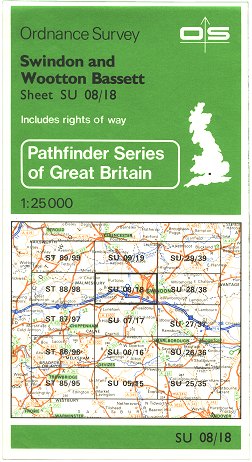 Figure 4 Pathfinder integral cover (1980 - c.1986) |
 Figure 5 Pathfinder card cover (1980 - c.1984) |
The series was rebranded ‘Pathfinder’ in early 1980, to tie in with the ‘Landranger’ tag of the 1:50 000 series. The ‘Pathfinder’ name reflected the 1:25 000 maps’ popularity with walkers. At the same time the cover was re-designed to include a detailed map of the surrounding sheets’ coverage based on 1:625 000 Routeplanner mapping. This design was printed on the map sheet itself in such a way that, when folded, the ‘cover’ appeared on the outside. (Figure 4).
Those sheets last reprinted before 1980 continued to be issued in re-branded hinged card covers (Figure 5) until they were reprinted with an integral cover.
1986-1990: The path to completion
The sheet numbering of the 1:25 000 Second Series originally followed a similar method to the First Series sheets, relating to the National Grid. This gave rise to such unwieldy sheet numbers as “NR 94/ parts 84, 95/ NS 04”. From 1986, however, the series was given consecutive numbers from North to South. Thus “NR 94/ parts 84, 95/ NS 04” became the much friendlier “Pathfinder 441”. At the same time, it was decided to discontinue or abandon any ‘Pathfinder’ sheets wholly underlying Outdoor Leisure maps.
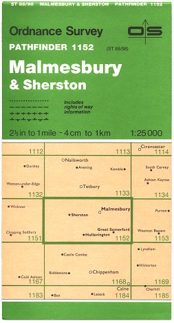 Figure 6 Pathfinder cover (1986 - 1988) |
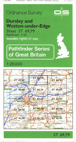 Figure 7 Pathfinder cover (c.1986 - c.1992) |
 Figure 8 Pathfinder cover (1988 - c.1992) |
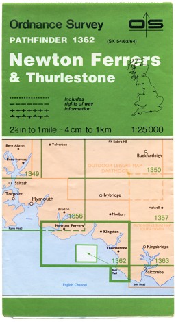 Figure 9 Pathfinder 1362 Edition A (Dec 1989) |
Newly-published or revised sheets from around Summer 1986 received a new cover design with the new consecutive numbers used as the primary sheet indentification. This new design did away with the detailed area map and reverted to a diagram of the surrounding sheets. This cover, again, was printed on the map sheet itself. (Figure 6)
Unrevised reprints issued from c.1986 continued to use the previous cover design but with the inclusion of the consecutive sheet numbers as a secondary means of identification. (Figure 7)
The new cover introduced in late 1986 had lacked the Great Britain shape from the previous design, but it was re-instated as a black outline in 1988. (Figure 8). From around 1992 unrevised reprints also received this design.
The series was finally completed in December 1989 with the publication of sheet 1362 [SX 54/63/64] Newton Ferrers & Thurlestone. (Figure 9)
1991-2003: Closing chapters
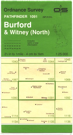 Figure 10 Pathfinder cover (c.1991 - c.1999) |
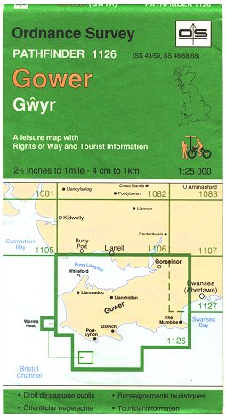 Figure 11 Gower Special Pathfinder (Apr 1992) |
 Figure 12 Pathfinder cover (c.1992 - c.1999) |
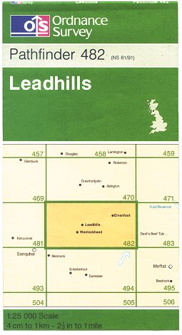 Figure 13 Pathfinder cover (1997) |
From 1991 the covers of several Pathfinder sheets had their titles re-lettered in a thinner font. (Figure 10)
Partially in response to a demand for larger 1:25 000 sheet sizes, and partially to test the water, two ‘Pathfinder’ sheets were joined together to cover the Gower Peninsula in a single sheet. This was the first Pathfinder sheet to have the Ordnance Survey logo in a distinct black-outlined box on the cover, and was published on 16 April 1992. (Figure 11). The experiment was largely successful and gave Ordnance Survey the encouragement to create a new series of selective-coverage 1:25 000 sheets - the Explorer series.
The slight cover re-design was subsequently applied to some of the rest of the series. (Figure 12). However most unrevised reprints during the 1990s retained the previous design(s). (Figures 8, 10)
By 1996, Pathfinder revision had slowed to a crawl, as much effort was being put into the Explorer series. Five Pathfinder sheets were revised between late 1996 and early 1997, and each was given a cover with the new Ordnance Survey logo and revised style, and also incorporating full-colour mapping similar to that found on the Explorer series (Figure 13). Details of the sheets found in this cover can be found on the themed collection page.
The 1:25 000 Explorer maps were originally intended as a selective-coverage series, similar to the Outdoor Leisure maps. However the decision was taken in late 1996 that the Explorers would replace the Pathfinders as the new national-coverage 1:25 000 series. As publication of the national Explorer series gathered pace from mid-1997 the Pathfinder maps were gradually withdrawn, being completely replaced by the Explorers in March 2003.
Page last updated: 30 September 2016