2000-2002: Touring the country
As the 20th century drew to a close, Ordnance Survey created a new line of Touring Maps, apparently aimed at those wanting a simple map of a ‘holiday area’ or perhaps those not quite so comfortable using maps.
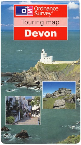 Figure 1 Devon Edition A (Mar 2000) |
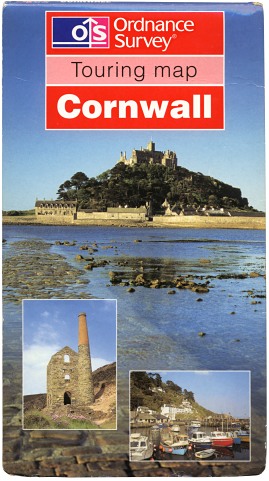 Figure 2 Cornwall Edition A (Mar 2000) |
The first two sheets in the series were published in March 2000. Devon and Cornwall used 1:250 000 mapping enlarged to 1:100 000 scale. Devon was printed double-sided while Cornwall was single-sided. They were issued in a style of cover first seen on the Scotland Touring Map in August 1999: a full-face cover photograph with inset photographs and a red title panel (Figures 1, 2). Their retail price at the time of their launch was £3.95.
The use of enlarged mapping made roads appear grossly exaggerated in width. The official press releases described the look as ‘uncluttered’ but with plenty of information of interest to tourists. However the maps received mixed reviews and highlighted the gap in Ordnance Survey mapping data between 1:50 000 and 1:250 000: since the abandonment of the Half-inch Map of Great Britain in the 1960s, virtually no prepared topographic OS mapping at a native scale around 1:100 000 is available.
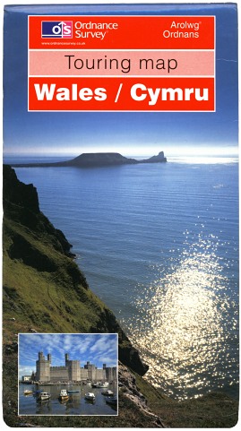 Figure 3 Wales / Cymru Edition A (Jun 2001) |
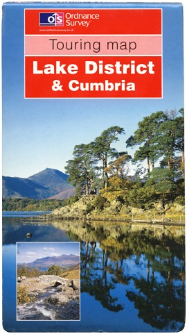 Figure 4 Lake District & Cumbria Edition A (Jun 2001) |
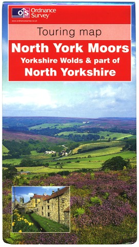 Figure 5 North York Moors Edition A (Feb 2002) |
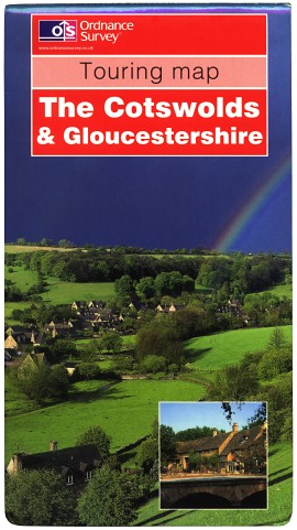 Figure 6 The Cotswolds Edition A (Feb 2002) |
Not deterred by the mixed reaction to the new Touring maps, OS published four more sheets in mid-2001:
- Wales (1:220 000) - pub. June 2001 (Figure 3)
- Lake District & Cumbria (1:110 000) - pub. June 2001 (Figure 4)
- Peak District & Derbyshire (1:100 000) - pub. July 2001
- Yorkshire Dales (1:100 000) - pub. July 2001
In Autumn 2001 the retail price of the Touring maps increased by four pence to £3.99.
There followed in February 2002 two more Touring maps at 1:100 000 scale: North York Moors (Figure 5) and The Cotswolds (Figure 6) - the last to be issued in the red-panelled full-face photographic covers. These two maps also replaced the very last maps at 1-inch scale produced by Ordnance Survey. The launch of the ‘OS Select’ service in April 2002, allowing consumers to order custom-coverage sheets (initially only from 1:50 000 scale mapping), was perhaps intended to provide a suitable alternative for anyone wishing to have a more detailed map of a particular area, albeit at £11.99 - three times the price of a Touring map! That price rose still further in early 2003 to £14.49 and later the same year to £15.99.
2002: New style, new name
 Figure 7 London including the M25 Edition A (Apr 2002) |
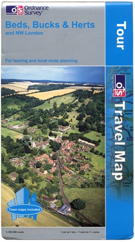 Figure 8 Beds, Bucks & Herts and NW London Edition A (Apr 2002) |
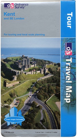 Figure 9 Kent and SE London Edition A (Apr 2002) |
The next sheets to be published were the first to be issued as ‘Tour’ maps in a new-style cover based on the ‘2002 house style’ first seen on the Landranger series in March 2002. They were also the first sheets in the series not directly replacing any of the former Touring map series. The set of five sheets covering the area round London were published in April 2002:
- London including the M25 (1:75 000) (Figure 7)
- Beds, Bucks & Herts and NW London (1:100 000) (Figure 8)
- Essex and NE London (1:100 000)
- Surrey, East & West Sussex and SW London (1:100 000)
- Kent and SE London (1:100 000) (Figure 9)
The light blue sheet title on the cover did not show up well against the silver panel.
Four of the five ‘Tour’ sheets published in April 2002 carried rear-cover sheet indexes, unlike the eight new Touring maps published since 2000. While the maps themselves remained un-numbered, these indexes showed the maps in the series so far with numbers roughly corresponding to the ‘old’ Touring map series, complete with gaps (i.e. omitting sheets 7, 9, 11 and 13), but including sheet 14 Northumbria which at the time was still one of the former Touring maps. Cornwall was numbered sheet 1 on the index, Devon was numbered 5 and the five London area sheets were numbered 15-19, exactly as they would all later be definitively numbered from mid-2004 onwards (see below). However the sheet indexes on the rear covers of all other ‘Tour’ maps published between mid-2002 and mid-2004 carried differing numbering without gaps, most of them explaining that the numbering referred to the diagram only.
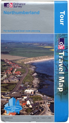 Figure 10 Northumberland Edition A (Jun 2002) |
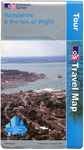 Figure 11 Hampshire & the Isle of Wight Edition A (Jul 2002) |
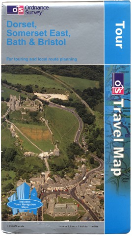 Figure 12 Dorset, Somerset East, Bath... Edition A (Jul 2002) |
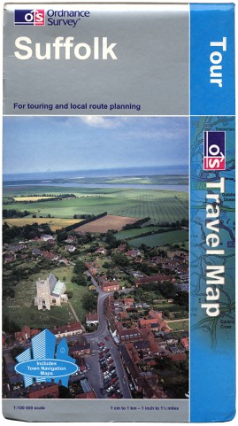 Figure 13 Suffolk Edition A (Oct 2002) |
The series expanded with more new additions during the Summer of 2002, all in the new-style cover:
- Northumberland (1:100 000) - pub. June 2002 (Figure 10) (replacing the Northumbria Touring map)
- Hampshire & the Isle of Wight (1:100 000) - pub. July 2002 (Figure 11)
- Dorset, Somerset East, Bath & Bristol (1:110 000) - pub. July 2002 (Figure 12)
Norfolk and Suffolk, both at 1:100 000 scale and published in October 2002, were the first sheets to be issued with the sheet title in white on the front cover, showing up much better than the previous light blue (Figure 13). In time the covers of the eight ‘Tour’ sheets first published with a light blue title were reprinted in the new style.
2003-2004: Changes and additions
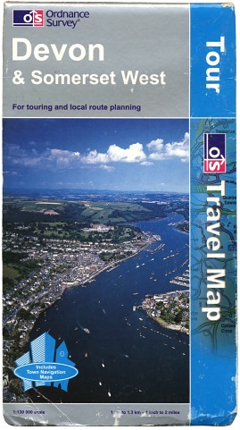 Figure 14 Devon & Somerset West Edition B (Mar 2003) |
 Figure 15 Oxfordshire & Berkshire Edition A (Apr 2003) |
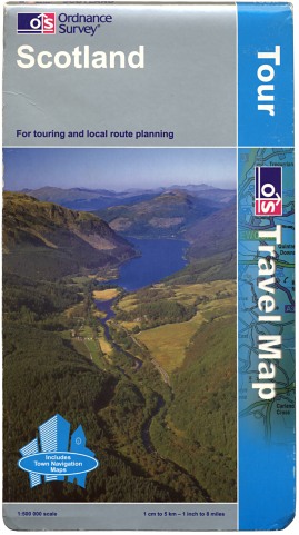 Figure 16 Scotland Edition A (Jun 2003) |
New editions (‘B’) of Cornwall and Devon were published in March 2003 as ‘Tour’ sheets in the 2002 house style cover. Devon changed title to Devon & Somerset West and, with a change of scale to 1:130 000, became single-sided. At the same time, the ‘Tour’ lettering at the top-right of the cover was enlarged and re-aligned. (Figure 14)
More new sheets were then published:
- Oxfordshire & Berkshire (1:100 000) - pub. April 2003 (Figure 15)
- Scotland (1:500 000) - pub. June 2003 (Figure 16) (created from - and replacing - the former Touring Map)
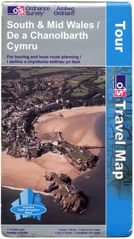 Figure 17 South & Mid Wales Edition A (Aug 2003) |
 Figure 18 Peak District & Derbyshire Edition A (Nov 2003) |
 Figure 19 Wiltshire Edition A (Feb 2004) |
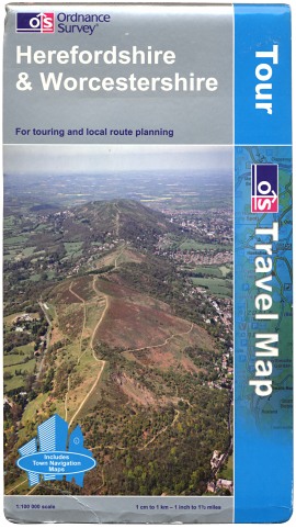 Figure 20 Herefordshire & Worcestershire Edition A (Feb 2004) |
The six remaining Touring maps - first published between June 2001 and February 2002 (see above) - were re-published between July and November 2003 as seven ‘Tour’ sheets (Wales was split into two new ‘Tour’ sheets: North & Mid Wales and South & Mid Wales, both at 1:175 000 scale). These seven ‘new’ sheets were each given edition code ‘A’. (Figures 17, 18)
A price increase across Ordnance Survey’s Leisure Map range in August 2003 brought the retail price of the ‘Tour’ maps from £3.99 to £4.99.
The extract of mapping used behind the ‘Travel Map’ lettering on the ‘Tour’ maps’ covers had, since April 2002, covered an area near Newquay in Cornwall; this was changed in Autumn 2003 to an extract covering part of the southern Lake District, as can also be seen from Figure 18 onwards.
February 2004 saw the publication of the last two new additions to the ‘Tour’ range: 1:100 000 scale sheets Wiltshire (Figure 19) and Herefordshire & Worcestershire (Figure 20).
2004-2007: Odd numbers
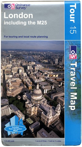 Figure 21 London including the M25 Edition B (Jul 2004) |
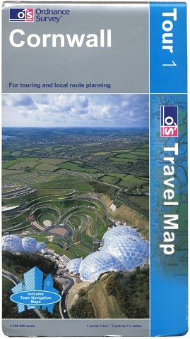 Figure 22 Cornwall - Edition B (pub. 2003, mid-2004 copy) |
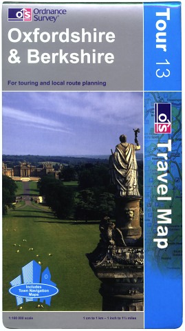 Figure 23 Oxfordshire & Berkshire Edition B (Nov 2004) |
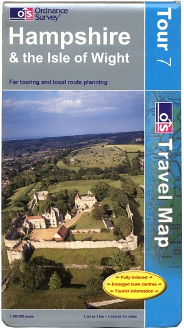 Figure 24 Hampshire & the Isle of Wight Edition B (May 2005) |
| ‘Tour’ map number & title | 1990s Touring map with same number and in approx. same area | |
| 1 | Cornwall | Dartmoor (very approximate!) |
| 2 | North York Moors & part of North Yorkshire | North York Moors |
| 3 | Lake District & Cumbria | Lake District |
| 4 | Peak District & Derbyshire | Peak District |
| 5 | Devon & Somerset West | Exmoor |
| 6 | Yorkshire Dales & part of North Yorkshire | Yorkshire Dales |
| 7 | Hampshire & the Isle of Wight | (Touring map 7 did not exist) |
| 8 | The Cotswolds & Gloucestershire | The Cotswolds |
| 9 | Dorset, Somerset East, Bath & Bristol | (Touring map 9 did not exist) |
| 10 | North & Mid Wales | Snowdonia & North Wales |
| 11 | South & Mid Wales | (Touring map 11 did not exist) |
| 12 | Scotland | Scotland |
| 13 | Oxfordshire & Berkshire | (Touring map 13 not in same area) |
| 14 | Northumberland | Northumbria |
| 15 | London including the M25 | (Touring map 15 not in same area) |
| 16 | Beds, Bucks & Herts and NW London | (Touring maps 16-23 did not exist) |
| 17 | Essex and NE London | |
| 18 | Surrey, East & West Sussex and SW London | |
| 19 | Kent and SE London | |
| 20 | Norfolk | |
| 21 | Suffolk | |
| 22 | Wiltshire | |
| 23 | Herefordshire & Worcestershire | |
Throughout the growth of the series, the ‘Tour’ maps had been un-numbered, and indeed numbered inconsistently on sheet indexes (see above). However in mid-2004 the 23 current ‘Tour’ maps were allocated definitive sheet numbers. Some sheets were given numbers which roughly matched those of former Touring Maps from the 1990s covering similar areas; other ‘Tour’ maps were numbered arbitrarily, with related sheets numbered contiguously (See table, right). The sheet numbers were printed on the ‘Tour’ covers and maps at the next available reprint published after June 2004. (Figures 21, 22, 23)
The cover symbol denoting the inclusion of town plans on the map was changed in mid-2005. The new yellow ellipse sits uncomfortably with the pale blue of the cover. (Figure 24)
‘Tour’ maps are revised on average once every two years, reprints with minor changes taking place as necessary inbetween. After 2007, some sheets which were subsequently discontinued in 2010 fell behind the nominal two-year revision cycle - perhaps an early reflection of poor sales.
2008: Odd episodes
 Figure 25 Scotland Edition B (Jun 2005) |
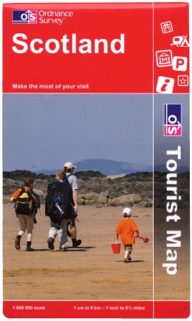 Figure 26 Scotland Tourist Map Edition A (Mar 2008) |
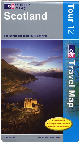 Figure 27 Scotland Edition C (Jul 2008) |
‘Tour’ sheet 12 Scotland is unusual in that its scale (1:500 000) is much smaller than that of any other sheet in the series. After its initial issue in June 2003 (Figure 16), it was reprinted with minor changes in April 2004 and then revised again in June 2005. (Figure 25). Nearly three years later, however, Scotland was to be the subject of a brief, but strange, episode.
On 10 March 2008, Ordnance Survey published a revised edition of the sheet for Scotland, slightly re-scaled to 1:600 000. This appeared in a boldly-designed short-format red cover - devoid of a sheet number - and carried ‘Tourist Map’ branding. (Figure 26). The initial print run consisted of 5,300 copies. Shortly after publication, however, it was realised that the new cover did not in fact meet Ordnance Survey’s own brand guidelines and indeed had not followed the “prescribed internal approval process”. In April 2008 a notice was issued to retailers explaining that no further copies of the map would be released until a replacement had been printed. Just 1,000 copies had been distributed before the withdrawal took place; the remaining 4,300 were ‘recycled appropriately’.
A new edition of the Scotland ‘Tour’ Map - continuing the previous line of editions, returning to 1:500 000 scale and back in a blue Tour Map cover - was published on 7 July 2008. (Figure 27)
It is understood a simliar ‘red-cover’ edition of ‘Tour’ sheet 5 Devon & Somerset West was also being prepared in March 2008 for publication in late April, but the withdrawal of Scotland meant it was never published. The next edition of Devon & Somerset West was in fact published in the standard style at the beginning of September 2008.
2009-2010: Printing matters
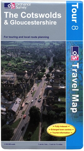 Figure 28 The Cotswolds & Gloucestershire Edition D (Jul 2009) |
 Figure 29 Scotland Edition D (Mar 2010) |
From Spring 2009 the Ordnance Survey logo at the top of the ‘Tour’ maps’ covers had its lettering changed from dark blue to white. (Figure 28). This change was applied to each sheet’s cover at its next available reprint.
As part of a review of cost efficiency in Autumn 2009, Ordnance Survey took the decision that the majority of the ‘Travel Map’ range could no longer compete with other companies’ similar products and satellite navigation devices. As a result fifteen of the 23 ‘Travel Map - Tour’ sheets were discontinued at the end of January 2010, concurrent with the complete demise of the 1:625 000 ‘Travel Map - Route’ and the 1:250 000 ‘Travel Map - Road’ series.
It was also at this time that Ordnance Survey decided to outsource printing of maps to an external company as part of its move to new premises, planned for late 2010. OS invited tenders from interested parties in November 2009.
‘Travel Map - Tour’ Scotland continued its tradition of oddity to become the subject of several firsts on publication of a new edition (‘D’) on 24 March 2010. (Figure 29). It was:
- The first ‘Tour’ map to be reissued without its sheet number;
- The first ‘Tour’ map to be published in a new edition without change to the ISBN or cover photograph - the result of a change in policy affecting all maps published by Ordnance Survey;
- The first OS map to promote on its inside cover just the three series remaining: Explorer, Landranger and Tour;
- The first OS map to carry subtly different cover typography (using Helvetica instead of Arial). This was a result of the creation of new master templates for OS’s map covers, in preparation for the outsourcing of map printing.
The seven other sheets left in the series - 1 Cornwall, 3 Lake District, 4 Peak District, 5 Devon & Somerset West, 8 The Cotswolds & Gloucestershire, 10 North & Mid Wales and 11 South & Mid Wales - were subsequently reprinted and reissued without their sheet numbers during the remainder of 2010.
The Ordnance Survey printing contract was awarded to Butler Tanner & Dennis on 2 September 2010. BT&D took on some of OS’s folding and finishing equipment as part of the agreement and began printing maps on 14 October. Seven weeks later - on 1 December - OS’s presses stopped rolling and BT&D took over printing completely.
2015-2016: Rebranding
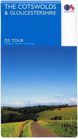 Figure 30 The Cotswolds & Gloucestershire 2016 edition (Feb 2016) |
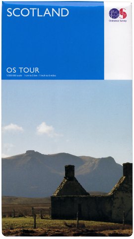 Figure 31 Scotland 2016 edition (Feb 2016) |
On 9 February 2015 Ordnance Survey revealed a new brand identity. A photography competition was launched by OS on the same day to invite members of the public to submit photographs for use on its range of map covers. Along with selecting photographs for the Explorer and Landranger series, the ‘OS Photofit’ competition saw photos for the ‘Tour’ series covers chosen from those entries submitted by people under the age of 17. The rebranded ‘Tour’ maps were published in February 2016. (Figures 30, 31)
Page last updated: 18 September 2016