1947-1959: A truly national series
Once it was clear that the 1-inch New Popular Edition was not going to be the standardised national series it had been hoped to be, thoughts turned almost immediately to its replacement. Work was begun in the autumn of 1947, and by the summer of 1949, a pilot sheet for the ‘1-inch Seventh Edition’, covering Hereford, had been produced.
The aim of the new series was to provide completely uniform 1-inch scale coverage of Great Britain, with greatly improved clarity and accuracy. In fact, as such, it was the first 1-inch series to completely cover Great Britain in a single series of standardised sheets. The sheet lines of the Seventh Series almost exactly matched those envisaged for the 1-inch New Popular Edition, covering Great Britain in 190 sheets, each 40km × 45km.
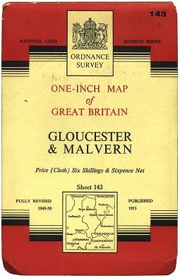 Figure 1 1-inch Seventh Series cover (c.1953) |
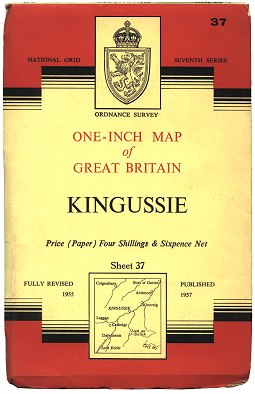 Figure 2 1-inch Seventh Series Scottish cover (1959) |
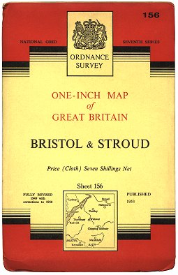 Figure 3 1-inch Seventh Series cover (1959) |
It was not until September 1952 that the first two sheets of the 1-inch Seventh Series were published: Sheet 109 Chester and Sheet 142 Hereford. The sheets were issued in either paper or cloth-backed format, in top-hinged card covers that were relatively simple in design yet commanded a certain respect. (Figure 1). For the sheets covering Scotland, the ‘coat of arms’ was replaced by a Scottish lion emblem adorned with the crown of King George VI. (Figure 2)
From January 1957 the Seventh Series covers in England & Wales were revised to incorporate the coat of arms of Queen Elizabeth II. (Figure 3)
1960-1965: Lengthened covers, combined sheets
As a result of local authorities in England & Wales beginning to produce their Definitive Maps of Public Rights of Way (RoW), Ordnance Survey began incorporating this information on 1-inch Seventh Series Maps from 1960. It took a good few years before every sheet in England & Wales carried RoW information, and even then coverage was not total because of the slow speed at which local authorities were providing information. Complete RoW coverage for England & Wales would happen long after the Seventh Series was dead and buried.
 Figure 4 1-inch Seventh Series cover (1963) |
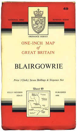 Figure 5 1-inch Seventh Series Scottish cover (1963) |
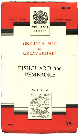 Figure 6 1-inch Seventh Series Sheet 138/151 cover (1967) |
In 1960 the covers were lengthened to allow the map inside to have only one horizontal fold in the middle. (Figure 4). It was not until 1963 that the covers for the Scottish sheets of the series were given a design incorporating the crown of Queen Elizabeth II - some 6 years after the England & Wales covers were so revised. (Figure 5)
In December 1965, the sheet total of the series was reduced to 189 sheets by the combination of overlapping sheets 138 Fishguard and 151 Pembroke into one large sheet, numbered ‘138/151’. (Figure 6)
1966-1976: Borrowed time
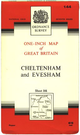 Figure 7 1-inch Seventh Series cover (1967) |
 Figure 8 1-inch Seventh Series cover (c.1970) |
The next change was the introduction of cover lamination from April 1966. This helped to preserve the covers better. (Figure 7)
The production of cloth-backed maps was abandoned in February 1968, and in 1969 the cover for the 1-inch Seventh Series was completely changed to the new Ordnance Survey ‘house style’. (Figure 8)
Thoughts were now turning towards a move to entirely metric mapping, and the days of the 1-inch map were numbered. Between late 1969 and 1971 several metric scale replacements for the 1:63 360 (1-inch) were considered, and eventually a scale of 1:50 000 was decided upon in the autumn of 1971.
The last revised reprints in the Seventh Series were issued in February 1974: sheet 61 Falkirk & Lanark edition B/*/*, sheet 83 Penrith edition B/*/*, and sheet 85 Durham edition B/*/*/*. The 1-inch Seventh Series sheets covering the southern half of Great Britain were withdrawn from March 1974, with the publication of the ‘southern block’ of the 1:50 000 Series. The 1-inch Seventh Series maps for the northern half of GB stayed in print until February 1976, when the ‘northern block’ of the 1:50 000 Series was published.
The 1-inch Seventh Series style lived on for a while, however: The 1:50 000 First Series were simply enlarged from 1-inch Seventh Series mapping, incorporating important revisions, and the 1-inch Tourist Maps based on Seventh Series material continued in print well into the 1980s.
Page last updated: 14 April 2012