1957-1964: Metric marvel
Despite the title of ‘Quarter-inch’ Fifth Series, the mapping was in fact at 1:250 000 scale - reflecting the gradual move towards metric-scale mapping by Ordnance Survey. The series, as laid out, covered Great Britain in 17 sheets, each 190km × 150km. The mapping was completely revised and redrawn from 1-inch Seventh Series material.
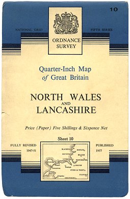 Figure 1 ‘¼-inch’ Fifth Series sheet 10 (1957) |
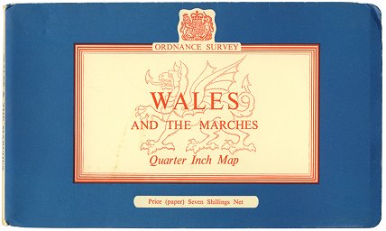 Figure 2 Wales & The Marches special sheet (1959) |
 Figure 3 ‘¼-inch’ Fifth Series sheet 16 Edition A (1963) |
The first sheet to be published was no. 10 North Wales and Lancashire in April 1957. This was given a blue variant of the familiar 1-inch Seventh Series cover. (Figure 1)
In August 1959, a special 1:250 000 sheet - Wales and the Marches - was published, drawn using the same style as the ‘¼-inch’ Fifth Series, but issued as a Tourist sheet. (Figure 2)
The next four sheets of the ‘¼-inch’ Fifth Series were published in the Spring of 1960, covering Wales and the north of England.
It took until January 1963 for publication of the series to be completed, with the publication of sheets 17 South East England and 16 Southern England. (Figure 3)
1965-1978: Sixties style, seventies utilitariansim
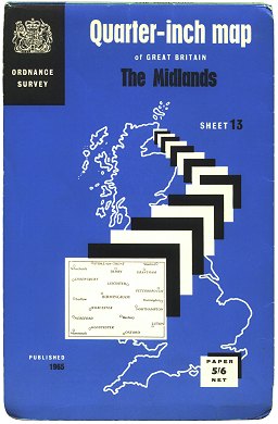 Figure 4 ‘¼-inch’ Fifth Series sheet 13 Edition B (1965) |
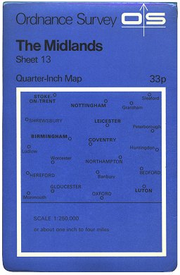 Figure 5 ‘¼-inch’ Fifth Series sheet 13 Edition C/*/*/* (1972) |
In 1965 a new cover was introduced - a distinctive 1960s design. (Figure 4)
With the introduction of the new Ordnance Survey logo and ‘house style’ in 1969, the ‘¼-inch’ Fifth Series followed suit in 1970. (Figure 5)
The ‘¼-inch’ Fifth Series was kept up to date until 1978. Fifth Series mapping was then used to make up a new set of sheets for the Routemaster series, after which the Fifth Series was discontinued.
Page last updated: 14 April 2012