2017: Back on route
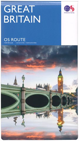 Figure 1 OS Route 2017 Edition (pub. Mar 2017) |
The 1:625 000 ‘Travel Map - Route’, along with many other OS small-scale maps, was discontinued in 2010 because of falling sales related to the growth of satellite navigation. However following the successful relaunch of the 1:250 000 ‘OS Road’ maps in September 2016 after a seven-year hiatus, it was announced in the OS Publication Report for February 2017 that a new Route Map was to be published at the end of March. The 2017 edition of ‘OS Route’ (Figure 1) is at 1:550 000 scale - slightly larger than its predecessor.
Page last updated: 3 April 2017